PINTO PEAK
DISTANCE: 14 miles
GAIN/LOSS: approximately 3200 feet
HIGH POINT: 7508 feet
LOW POINT: 5318 feet
BEST TIME OF YEAR: October through April
There are two trailheads which are often used for the climb up Pinto Peak:
Towne Pass (4956 feet) and Emigrant Pass (5318 feet). Starting from Towne
Pass results in a shorter and more direct route, but there is no actual trail. Oddly
enough, despite the fact that Towne Pass is not as high as Emigrant Pass,
the hike from Towne Pass involves less overall gain/loss due to the
roller coaster like route beginning at Emigrant Pass. However, the route to
Pinto Peak from Emigrant Pass follows an old truck road which was closed
decades ago. Following the road results in a 15.5 mile roundtrip, but utilizing a
strategtic shortcut can reduce the total length of the hike by about a mile and a half.
|

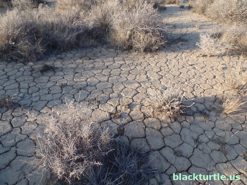
Mud cracks in playa along route to the peak.
(click to enlarge)
IMAGES:
Pinto Peak (June 2018)
Pinto Peak Trail (October 2017)
|
TRAILHEAD:
Emigrant Pass is located on Emigrant Canyon / Wildrose
Road. The road is paved from Highway 190, but from Panamint Valley a section
is unpaved and often closed after a major storm. As far as distance, it's
about 13.5 miles from the north to Emigrant Pass from Highway 190 and about
17.5 miles from the south to Emigrant Pass from the intersection of Wildrose
Road and Panamint Valley Road. There are two closed dirt roads at Emigrant
Pass. One heads off downward to the southwest and is clearly blocked by a
sign. The other takes off upward to the northwest and is badly overgrown.
It should come as no surprise that the one heading upward to the northwest
is the one to take!
HIKE DIRECTIONS:
You can follow the road all the way to the peak if you'd like, but there is
a strategic shortcut that can save about 1.5 miles on the overall distance.
As already mentioned, the road is badly overgrown with low-growing shrubs
along its entire distance. In some places the road is barely visible, but at
no time is it currently necessary to slow down to figure out where the road
is unless you're hiking in the dark. The road follows ridgelines the entire
way to the peak and has lots of ups and downs as a result. The first few
miles are treeless and desolate. It's not until dropping steeply into a
playa at about 3.5 miles into the hike that junipers are present.
Just after crossing the playa you need to decide whether or not to take the
shortcut. Follow the road and your way is clear. Otherwise a little
route-finding is necessary. In any case the views are spectacular. Tucki
Mountain (6,726 feet), Bald Peak (7,764 feet), Wildrose Peak (9,064 feet),
and Telescope (11,049 feet) are prominently visible to the east. In the
distance the Grapevine Range, Argus Range, Dry Mountain, Inyo Range, Sierra
Nevada Range and more are within sight. Also a great view down into nearby
canyons is provided along the ridge to the peak.
|
Key Shortcut:
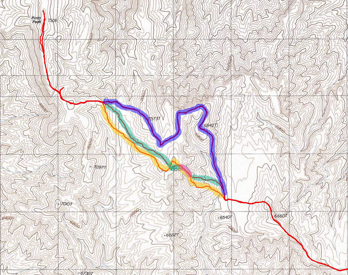
Inspect the map provided to the right. The key parts of
interest are highlighted in blue, green, and yellow with a short section in
pink. The blue section follows the road, whereas the green and yellow sections
show the short cut I took. The short pink section is where the two routes
overlap. The best route was the green route. For over a half mile it follows
the course of a wash through lots of large cedar trees. As you can see it
would be easy to reconnect with the road earlier along this route at a point
where the road makes a sharp turn. Connecting there would retain the full
value of the shortcut.
A popular guidebook recommends doing this hike between October and April. I
did the hike twice in June 2018 (once for the road section and once to
figure out the shortcut). I selected days which were relatively cool for
June. In fact, on the second time up and down the peak I had to put on a
windbreaker since it was pretty cool and windy.
|
Recommendations: I enjoyed the shortcut route more than staying on the road.
Not only is it a bit shorter, but it's also more scenic in my opinion.
Either way the hike is not as spectacular as Wildrose or Telescope, but it
offers some unique views that make it sufficiently enjoyable as to be worth
the effort.

Click map to enlarge in new window!
|

|


|

|

|
Entire site,
Copyright ©
2003-2024
blackturtle.us

|
|