Deer Mountain Loop
DISTANCE: 14 miles
GAIN/LOSS: 1200 feet (approx)
HIGH POINT: 8660 feet
LOW POINT: 7620 feet
BEST TIME OF YEAR: Summer and early Autumn
This hike circumnavigates Deer Peak, located just southeast of
Monache Meadows in the southern portion of the Sierra Nevada range. The
route may be extremely faint in some areas, especially following heavy
storms or early in the summer. Along the northern portion of the loop, cows
are likely to be encountered. Interesting landmarks along the way include a
stock bridge, Dutch John Flat, and an old cowboy campsite.
Part of this loop follows the Pacific Crest Trail.
|

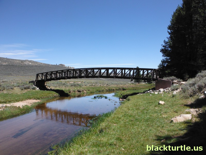
Stock bridge crossing Kern River (click to enlarge)
IMAGES:
Deer Mountain Loop (July 2013)
|
TRAILHEAD:
These directions are general. Consult a map and verify the route before
attempting to travel to the trailhead. From Highway 395 turn west towards
Kennedy Meadows a few miles north of Pearsonville. It is about 27 miles from
Pearsonville to Kennedy Meadows. Drive through Kennedy Meadows and continue
towards Sherman Pass. However, turn north on 21S03 and continue several
miles beyond the Blackrock Ranger Station and turn right onto 21S36.
Continue on 21S36 for approximately three miles and turn north onto the
Monache Jeep Trail.
Follow the Monache Jeep Trail for seven miles to arrive at Monache Meadows.
Once at the meadows cross the Kern River and drive to the east side of the
meadow area. From there turn south and continue to the parking area near Beck
Meadow at the edge of the wilderness area. A road
continues south, but this road is not open to the general public. It is used
by the ranchers who graze their cattle in the Monache Meadows area. (The
Monache Jeep Trail requires high clearance.
There are a few rough areas, but the trail is not a major
challenge for experienced off-road vehicle users.)
HIKE DIRECTIONS:
From the parking area hike south and cross the Kern River and then turn east
a short distance south of the crossing. Follow the trail east and then south
as it follows the course of the South Fork of the Kern River. At a little less than two
miles the stock bridge pictured above is reached and on the east side of the
bridge a sign will be encountered. Continue south here. The trail
crosses the river several times. Some of these river
crossings can be avoided, while others are difficult to avoid. The route
remains relatively flat for the first several miles.
At about 4.5 miles into the hike the trail climbs to the west of the river
and proceeds over a ridge before dropping down to Dutch John Flat (the lowest point of the
hike). You will find a trail
junction here. Take the route heading west towards the Pacific Crest
Trail. The trail climbs steeply at this point and soon you arrive at a
meadow at an elevation of slightly over 8600 feet. The cowboy camp is
located here, south of the trail. After passing through
this meadow area the trail then drops steeply until reaching the Pacific
Crest Trail. Follow the PCT north to Beck Meadow. At Beck Meadow a road
proceeds north back to the parking area. Alternatively, the PCT can be followed for
another mile, in which case you will need to retrace the first half mile or
so of the
hike in reverse.
NOTE: When I did this hike much of the trail between Dutch John Flat and the
PCT was washed out. A heavy storm had hit the area about ten days earlier.
This storm, in fact, closed parts of Highway 395 and several routes
throughout Inyo County. Hopefully, when you do this hike, the trail will be
much easier to follow!
Additional Information:
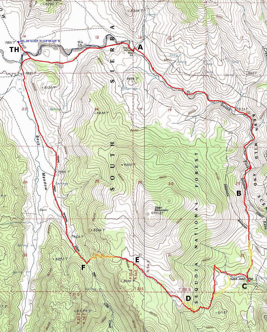
The following points of interest are identified on the map:
A) Stock Bridge
B) Area where trail leaves the Kern River and climbs ridge.
C) Dutch John Flat
D) Washed out trail (also highlighted in yellow).
E) Location of cowboy camp.
F) Junction with Pacific Crest Trail.
|

Click map to enlarge in new window!
|

|